New Brunswick
New Brunswick’s Bay of Fundy, along with the Saint John (Wolastoq) river floodplain, is one of the EHJV’s focus areas for bird habitat conservation. Located between Nova Scotia and New Brunswick, it has the world’s highest tides, rising and falling an average of 50 feet (the height of a four-story building) daily. Chignecto Bay, located at the northern part of the Bay of Fundy, is a Western Hemisphere Shorebird Resource Network (WHSRN) site of international importance – hundreds of thousands of Semipalmated Sandpipers and other shorebirds rely on the habitat as part of their semi-annual migrations. New Brunswick EHJV partners secure and restore habitat for waterfowl and other important migratory birds, including shorebirds, in eight high-priority eco-districts in the province which includes important features such as the Bay of Fundy, Saint John (Wolastoq) River and the Chignecto Isthmus.
New Brunswick Partners
- New Brunswick Department of Natural Resources and Energy Development (Implementation Lead)
- Birds Canada
- Ducks Unlimited Canada
- Environment and Climate Chance Canada, Canadian Wildlife Service
- Nature Conservancy of Canada
- Nature Trust of New Brunswick
- New Brunswick Department of Environment
- Department of National Defence
NB-EHJV Expenditures
January 1, 1986 – March 31, 2020
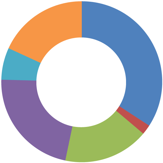 ■ Habitat Retention (Secured) – 34%
■ Stewardship/Influenced – 2%
■ Habitat Restoration (Enhanced) – 17%
■ Management – 22%
■ Habitat JV Science – 7%
■ Other Activities – 18%
Other activities include policy work, communications, education and conservation planning.
New Brunswick Accomplishments
January 1, 1986-March 31, 2020 and January 1, 2015 – March 31, 2020* (current Implementation Plan)
| Habitat Retention |
|
|||||
| Permanent | 30,605 | 3,065 | ||||
| Medium (10-99 yrs) | 33 | 33 | ||||
| Stewardship/Influenced (< 10 yrs) | 380,340 | 0 | ||||
| Habitat Restoration (Enhancement) | ||||||
| Upland | 1,880 | 5 | ||||
| Wetland | 8,472 | 505 | ||||
| TOTAL** | 410,978 | 3,098 | ||||
* Activities from January 1, 1986-December 31, 1988 were completed as first step projects prior to the official formation of the EHJV
** Habitat hectares retained, restored and managed are not additive. Hectares are first secured, may then be enhanced and are subsequently placed under management.
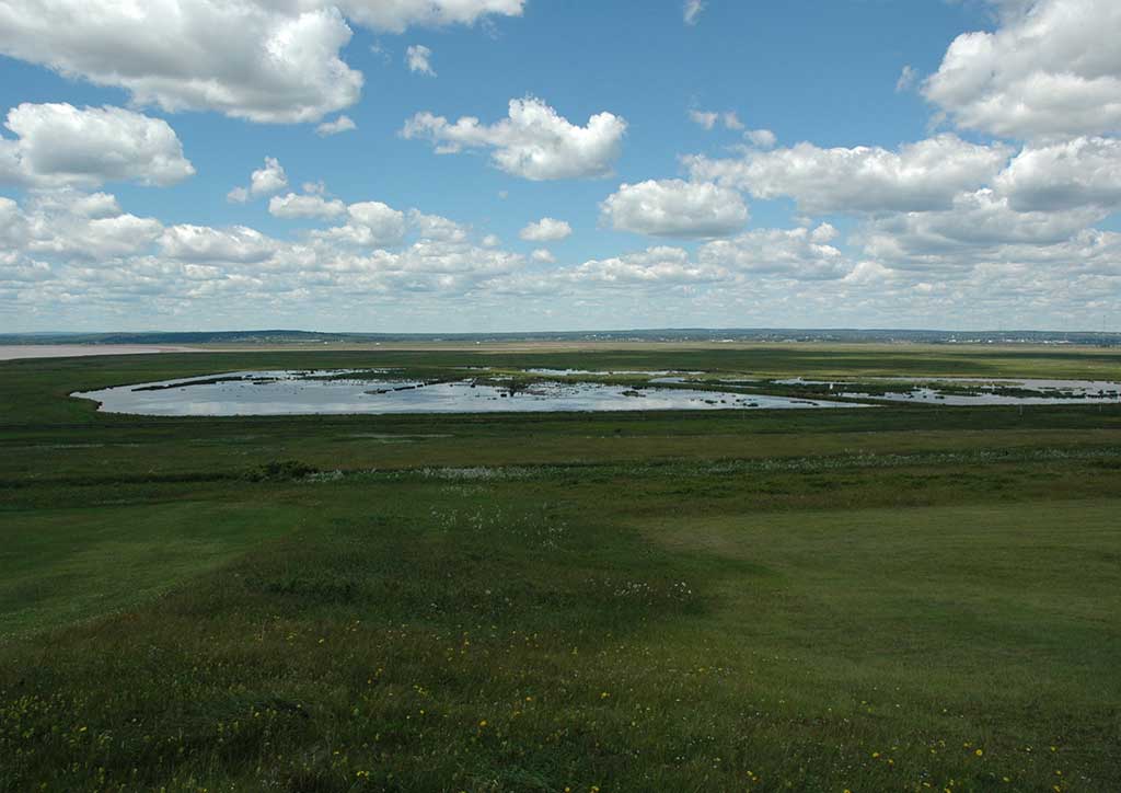
Tantramar Dykelands – JB Pollard
Project Highlights
Wetland Mapping in New Brunswick
On January 1st, 2020, the New Brunswick Department of Environment and Local Government launched an improved mapping tool of provincial wetland locations known as the Watercourse and Wetland Alteration WAWA Reference Map. This new resource is a composite of the latest available data, incorporating both LiDAR and Aerial Imagery. The new mapping tool will be updated on an annual basis with any data received or collected within that year to continuously improve the map’s accuracy. It is intended to help landowners, resource users and the general public have a better understanding of where wetlands are located for improved management and stewardship of the Province’s wetlands, in accordance with the Clean Water Act.
Tantramar Wetlands Centre
Johnson’s Mills Shorebird Reserve and Interpretive Centre
Musquash Estuary
Tabusintac Estuary
Portobello Creek National Wildlife Area
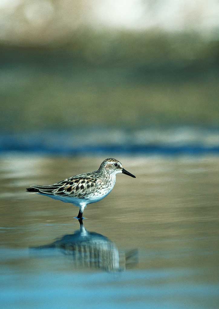
Semipalmated Sandpiper – © Ducks Unlimited Canada
Portobello Creek is the largest freshwater wetland complex within the lower Saint John River (Wolastoq) floodplain with productive habitats for waterfowl and other wildlife species in NB and is home to the Portobello Creek National Wildlife Area (NWA). In 1973, the Government of Canada committed to purchasing 4,047 hectares (10,000 acres) of wetland habitat at Portobello. Established on August 30, 1995, the NWA, encompasses 2,090 hectares (5,164 acres) and is home to at least 39 species of rare plants including Butternut tree, a federally listed species at risk. Since 2011, the Government of Canada has acquired an additional 1,122 hectares (2,771 acres) of wetland and wetland buffer habitat within the Portobello Creek system.
Contact
Elisabeth Belanzaran
New Brunswick EHJV Coordinator
New Brunswick Department of Natural Resources and Energy Development
Elisabeth.Belanzaran@gnb.ca